


Rumtse – Tso Moriri trek
Meet the Drukpa nomads of the Changthang plateau and enjoy the stunning views of Tso Kar and Tso Moriri lake
Have you heard of a trek in the Himalayas that takes you through seven passes, ten river crossings and amazing campsites, all higher than 4500 m ?
Well, if you haven’t yet, Himalayan Ecotourism is pleased to say that we also take you on the Rumtse – Tso Moriri Trek where you can witness the magnificence of all of the above, right in front of your eyes.
Despite the physical challenges posed by the trek’s elevation changes, the allure of the Himalayan beauty, enhanced by diverse wildlife and breathtaking views of the Changthang plateau and wetlands, is bound to captivate you.
As you traverse this challenging terrain, camping at Rachungkharu – the sole summer-inhabited Changpa settlement, provides a unique opportunity to engage with Changpa nomads, renowned for their distinct Tibetan culture and historical nomadic journeys between Ladakh and Lhasa.
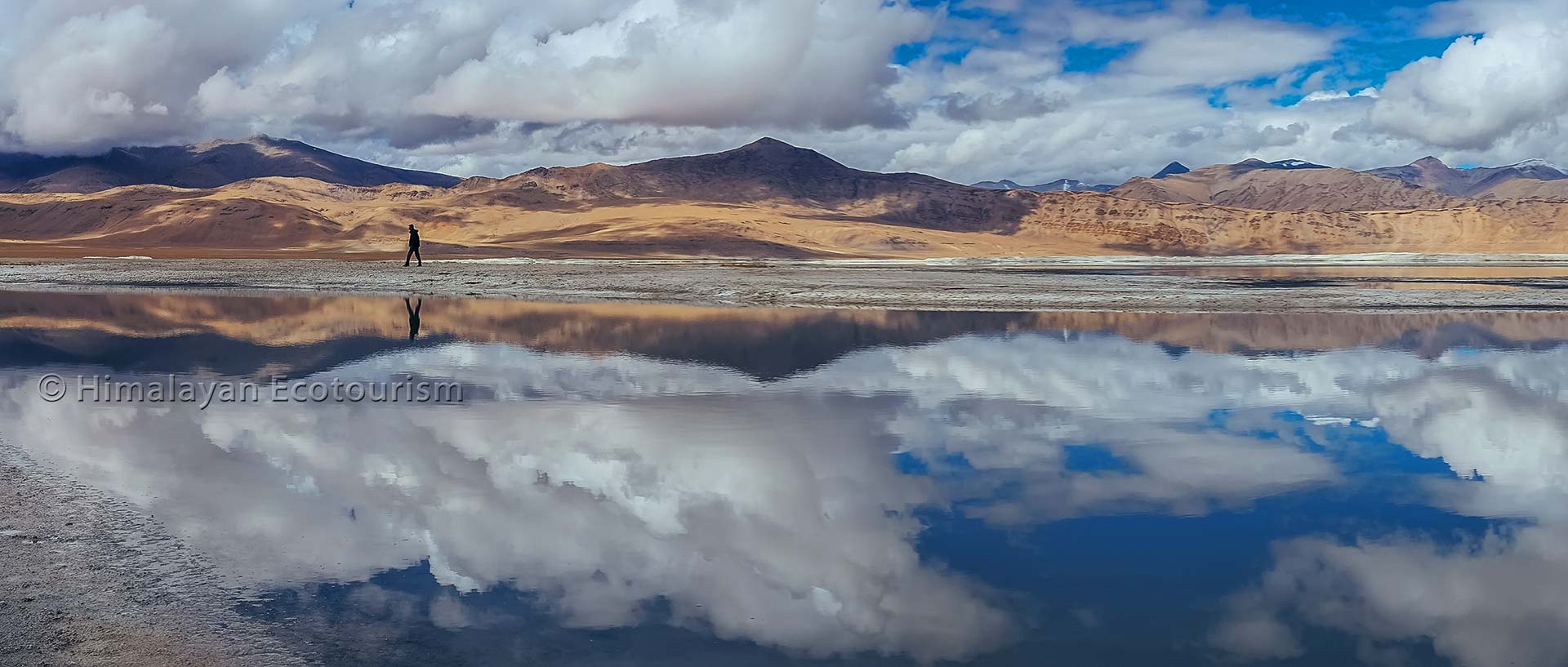
And,the surreal panorama of the brackish Tso Kar and the sapphire blue Tso Moriri will surely leave an imprint.
As the Changthang Plateau is known for its birds,keep your ears open for songbirds such as the Horned Lark and the seed-eating Finch. The Brown Headed Gull, Brahminy duck and The Bar Headed Goose, known to be the highest flying bird in the world, can also be found here. The high plateaus of the area are also home to some mammals such as the Kyang (wild ass), blue sheep, marmots, Himalayan Ibex and snow leopards.
Embark on this trek with Himalayan Ecotourism, an excellent alternative to the relatively popular Markha Valley route. Not only does it offer a serene escape with fewer fellow trekkers, but it also presents a more breathtaking and demanding adventure.

Rumtse to Tso Moriri trek features
Duration of your trek
Day-min : The minimum number of days required for the trek (from Leh to Leh)
Day-max : The maximum number of days you can spend on this trek. Prolonged itinerary can be discussed with our team.
AWTD : Average walking time per day (<3 : easy, 3 to 5 : moderate, >5 : strenuous)
Altitudes of your trek
Min : Minimum altitude of your trek.
Max : Maximum altitude of your trek.
Ascent : The total ascending difference of altitude on the trek.
Descent : The total descending difference of altitude on the trek.
Difficulty of your trek
Stamina : The physical effort involved during your trek. Rated from 0 (easiest) to 100 (most strenuous). If you have an average fitness you can consider all the treks up to 50. See here for more details
Technical : Difficulty of your trek in terms of exposure to danger and required experience.
0 to 20 : No difficulties,
20 to 40 : Walking on good mountain trails,
40 to 60 : Some walking on difficult mountain trails (steep slopes, rocks, etc.),
60 to 80: You are exposed to some dangers (void, snow, falling rocks, etc.),
80 to 100 : Experience required (please inquire).
Overall : Average between Stamina and Technical rating.
Duration
Altitudes
Difficulty
Rumtse to Tso Moriri trek map

RUMTSE TO TSO MORIRI TREK ITINERARY
The trek starts from Rumtse located on the Manali to Leh highway. You are going to cross 7 challenging passes to reach one of the most beautiful lake of Ladakh – Tso Moriri. The trek ends at Karzok.
Rumtse Tso Moriri trek elevation profile

Rumtse Tso Moriri trek ascent and descent
The gradient of the slopes remains gentle on this trek. But the high altitude can make the crossing of the passes pretty strenuous.
Rumtse to Tso Moriri, best time to go
Best time to trek to Tso Moriri is from May to September In early season you may not be able to cross the high passes because of the snow.
The best trekking season coincides with the time many shepherds go along the same trekking trails. It is also the best time for birdwatchers at both the lakes Tso Kar and Tso Moriri.
JAN
Avoid
FEB
Avoid
MAR
Avoid
APR
Avoid
MAY
You may go
JUN
Best time to go
JUL
Best time to go
AUG
Best time to go
SEP
Best time to go
OCT
You may go
NOV
Avoid
DEC
Avoid
Other treks and experiences in Ladakh

Treks in Ladakh
Our selection of treks in Ladakh and Zanskar, one of the most stunning region on earth !

Ladakh village experience
For the real travellers who want to discover the local culture and its landscape

Ladakh Experience journey
Get an idea of what travelling with a social enterprise really means in Ladakh.
From our gallery
Rumtse to Tso Moriri trek photos
Itinerary
Day One : Leh to Rumtse
| FEATURES | DESCRIPTION | ||||
|---|---|---|---|---|---|
|
Today, trekkers will be leaving Leh to reach Rumtse village on the same day which is a 76 km drive. The stay will be organized in a homestay in Rumtse village. Since Rumtse is at a much higher altitude than Leh, trekkers will not be doing any activity on this day in order to acclimatize and not get altitude sickness. |


Day Two : Rumtse to Kyamar
| FEATURES | DESCRIPTION | ||||||
|---|---|---|---|---|---|---|---|
|
Trekkers will start with the trek from Rumtse to reach Kyamar campsite at 5120 m. The duration of this patch is approximately 5 hours and covers about 13kms. The trail goes via Jammu and Kashmir Tourism hut and you will have to hike beside the Chhaba Chu stream. Before reaching Kyamar campsite, you'll need to make your way through many small river streams, green marshes and tackle some rough spots on the trail. Surrounded by barren, rocky mountains on three sides, the campsite provides a rugged yet picturesque backdrop for a peaceful rest under starry night in tents. |


Day Three : Kyamar to Tisaling
| FEATURES | DESCRIPTION | ||||||
|---|---|---|---|---|---|---|---|
|
This day will involve passing through two high passes - Kyamar La Pass at 5120 m and Mandalchan La Pass at 5200 m. The duration of trekking can go up to about 8 hours, covering approximately 15 kms.The trail begins with a gradual ascent towards Kyamar La, which gives you a breathtaking view of Changthang plateau with its colorful wildflowers spread across. After the pass, trekkers descend towards Tiri Doksa, a temporary shelter for the shepherds. Keeping up with the trail, trekkers cross Mandalchan La and descend to Tisaling campsite at 5030m for the night. Tisaling is a beautiful high altitude grassland between Mandachalan La and Tisaling La. |
Day Four : Tisaling to Pongunagu
| FEATURES | DESCRIPTION | ||||||
|---|---|---|---|---|---|---|---|
|
On this day, trekkers will gently ascend towards Shibuk La at 5280 m, moving towards the plains of Tso Kar Lake. Trekkers should expect a long descent here overlooking Tso Kar. If lucky, trekkers will come across Changpas with their livestock which is a sight in itself. The brackish barren land changes its colors at different times of the day. Here, trekkers have a chance to spot migratory birds, kiang (wild asses), marmots and ibex. The night will be spent camping at Tso Kar campsite/Pongunagu at 4600 m. The time taken to reach the campsite will be approximately 6 hours, covering 15kms. This is the only point of exit on the trek, in case of emergencies. A satellite phone is also available in the nearest village, Thugje, 3 km away from the campsite. |
Day Five : Pongunagu to Nuruchen
| FEATURES | DESCRIPTION | ||||||
|---|---|---|---|---|---|---|---|
|
This day poses fewer challenges in terms of the ascent and the descent. Trekkers will get to enjoy the long walks on the plains of Tso Kar, providing a very close look of the Tso Kar Lake. The goal is to reach Nuruchen, a Changpa village at 4660 m. The valley widens as you proceed towards Nuruchen with Zanskar ranges looming ahead. You can easily spot the Horlam La ridge. Make sure you carry ample amounts of water due to the lack of water source on the trail. Trekkers may look out for black necked cranes and Brahminy ducks as it is their breeding ground. The trail passes by a few tea shops and winter shelters used by Changpa folk, stop here and relish the local tea and snacks made by them. The duration to reach Nuruchen campsite is approximately 6-7 hours, covering 16 kms. Nuruchen serves as a refuge for the Changpas during the harsh winter months, providing a safe haven. In the summer, the village takes on a ghostly appearance with its deserted huts. A muddy stream, Nuruchen Lungpa, flows down from the Horlam La ridge on the southwest side, eventually draining into the Tso Kar Lake. |
Day Six : Nuruchen to Rachung Karu
| FEATURES | DESCRIPTION | ||||||
|---|---|---|---|---|---|---|---|
|
Today, trekkers will be passing through Horlam La. Since, Horlam La is the easiest pass crossing of this trek, today will be a relatively relaxed day. Trekkers will witness an increasing presence of the Changpas and Tibetan Wild Horses. We will descend to Rachungkharu where trekkers will camp overnight.The duration to reach the campsite will be approximately 3-4 hours covering 9 kms with multiple river crossings. Rachungkharu is one of the Changpa’s summer settlements and unlike the other settlements this one will not be deserted. |
Day Seven : Rachung Karu to Gyamar
| FEATURES | DESCRIPTION | ||||||
|---|---|---|---|---|---|---|---|
|
On this day, trekkers will again pass through two major passes - Kyamayuri La at 5420 m and Gyamar La at 5390 m. The goal would be to reach Gyamalhoma campsite. Trekkers will witness a changing landscape as they approach a higher mountain range. Trekkers will have an exhilarating experience with multiple river crossings which can be a bit tricky and has to be forded quite carefully. The time taken to reach the campsite is approximately 6 hours covering 13 kms. Gyamalhoma is a beautiful pasture ground frequented by Changpa yak herders. It is the base camp for climbing Mentok 1 and 2 peaks. |
Day Eight : Gyamar to Karzok
| FEATURES | DESCRIPTION | ||||||
|---|---|---|---|---|---|---|---|
|
This final day of the trek is the most spectacular of all. Trekkers will pass through the highest pass of the entire trek - the Yalung Nyau La Pass at 5440 m. The valley is barren and prone to rock fall. Upon reaching the highest point of the pass, the sight of Tso Moriri lake for the first time is truly breathtaking. Some famous trek-worthy peaks like Chhamsher Kangri and Lungser Kangri are clearly visible from here. Along with the best views of the entire trek, you will pass through rocky terrains and will eventually take you to the pastured land of Karzok Phu.The approximate duration will be around 6 hours covering 14 kms. After a long descent from the pass, trekkers will reach Karzok where they will camp overnight. |
Day Nine : Karzok to Leh
| FEATURES | DESCRIPTION |
|---|---|
| No walk No stay | The trek ends here, and today trekkers will drive back to Leh. The approximate duration will be around 6-7 hours covering 210 kms. |
Gallery
Rumtse to Tso Moriri trek photos
Share your feedback
Thank you for sharing your experience! Your feedback is invaluable and inspires fellow travelers to choose responsible tourism when they journey with us.