


Pin Parvati Trek
Pin Parvati Trek: The trek of Himachal Pradesh !
The Pin Parvati Pass connects the Spiti area with the Kullu area via the Pin and Parvati valleys. This trek allows you to go though most of the ecosystems of these two very different areas. Be sure to have a rich and unforgettable experience of the Western Himalayas.
the trek is a quite strenuous and so you need to be physically fit. Do not do the Pin Parvati as your first trek as you may encounter difficulties you were not prepared for. Pin Parvati pass trek is a good challenge for nature lovers and adventure seekers.
On the second day you will enjoy the hot waters at Kheer Ganga. Then it is a gradual climb through dense forest, large meadows, steep gorges and other glacier-made landscapes.
The nature will progressively take the place of the civilization and offer you peace throughout your journey.
Except for the first night at Kalgha all other nights are spend under tents on beautiful meadows or on ice near the pass. You will see some incredible landscapes, glaciers and then Buddhist villages in the region of Spiti.

Pin Parvati Trek features
Duration of your trek
Day-min : The minimum number of days required for the trek
Day-max : The maximum number of days you can spend on this trek. Prolonged itinerary can be discussed with our team.
AWTD : Average walking time per day (<3 : easy, 3 to 5 : moderate, >5 : strenuous)
Altitudes of your trek
Min : Minimum altitude of your trek.
Max : Maximum altitude of your trek.
Ascent : The difference of altitude between the trek starting point and the highest point of the trek.
Descent : The difference of altitude between the highest point of the trek and the trek ending point.
Difficulty of your trek
Stamina : The physical effort involved during your trek. Rated from 0 (easiest) to 100 (most strenuous). If you have an average fitness you can consider all the treks up to 50. See here for more details
Technical : Difficulty of your trek in terms of exposure to danger and required experience.
0 to 20 : No difficulties,
20 to 40 : Walking on good mountain trails,
40 to 60 : Some walking on difficult mountain trails (steep slopes, rocks, etc.),
60 to 80: You are exposed to some dangers (void, snow, falling rocks, etc.),
80 to 100 : Experience required (please inquire).
Overall : Average between Stamina and Technical rating.
Duration
Altitudes
Difficulty
Pin Parvati trek map

PIN PARVATI TREK ITINERARY SUMMARY
The Pin Parvati trek starting from the Kullu side is a long and gentle ascent following the Parvati river upto the Mantalai lake. Shortly after the lake you have a steep climb on a glacier to reach the pass. After the pass you are in the Pin valley in which you descent upto Mud.
Best time to trek to Pin Parvati
Best time to trek to Pin Parvati is from end of June to September.
You may also consider early June if the snow conditions permit.
JAN
Avoid
FEB
Avoid
MAR
Avoid
APR
Avoid
MAY
You may go
JUN
Best time to go
JUL
Best time to go
AUG
Best time to go
SEP
Best time to go
OCT
You may go
NOV
Avoid
DEC
Avoid
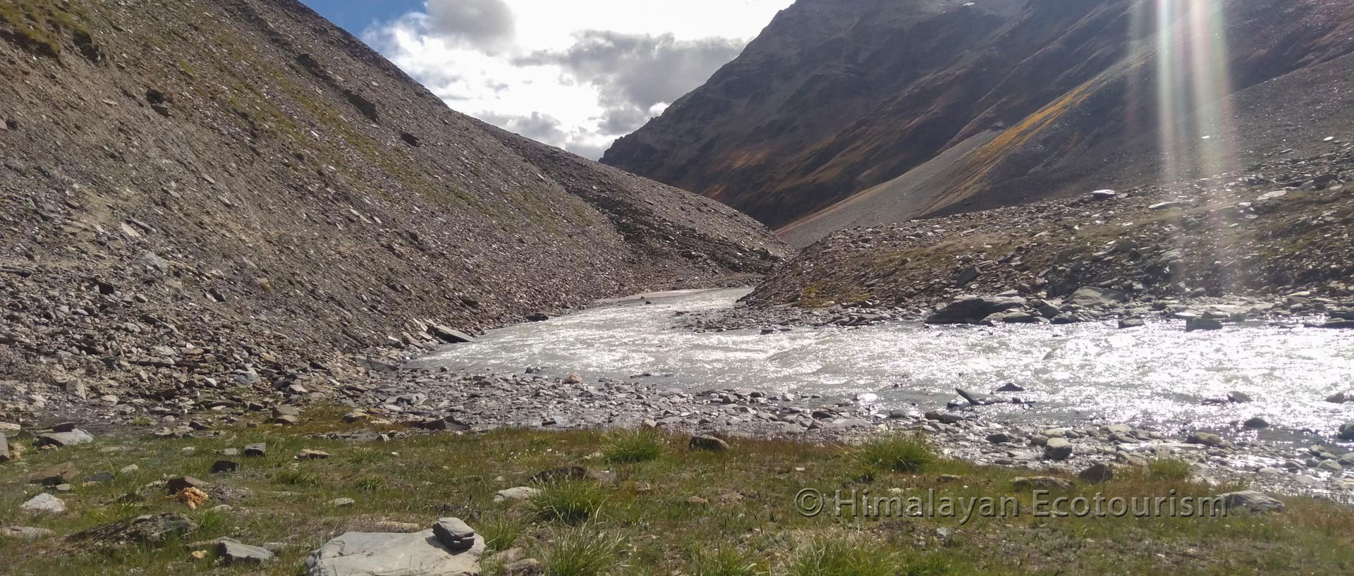
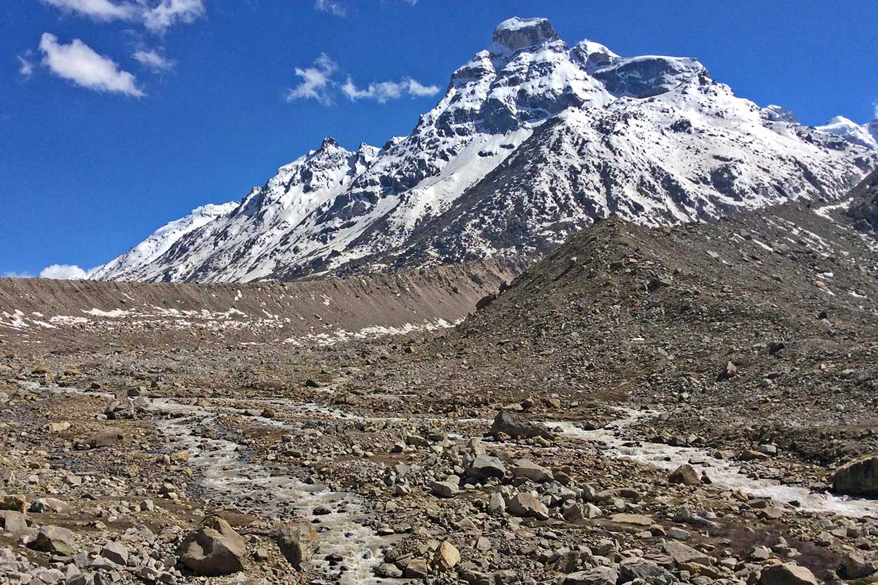
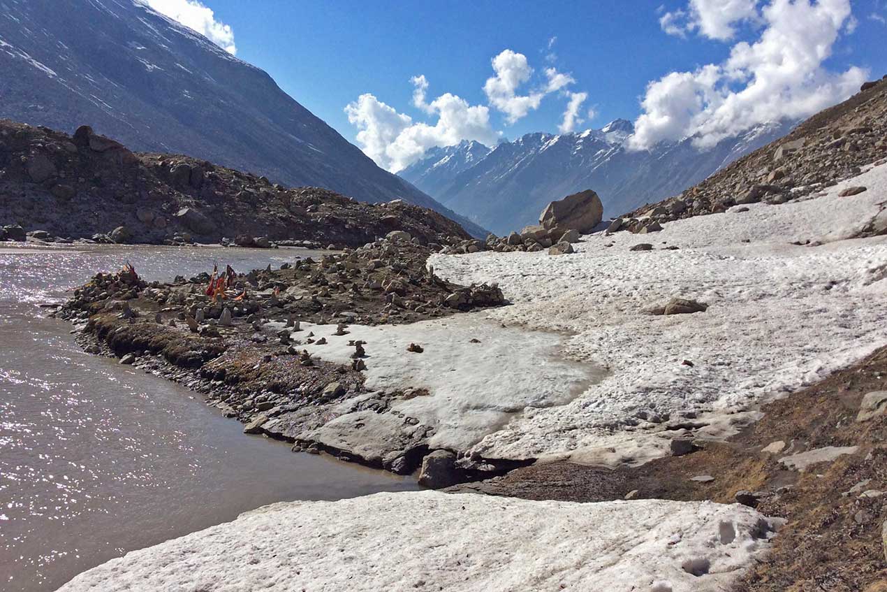
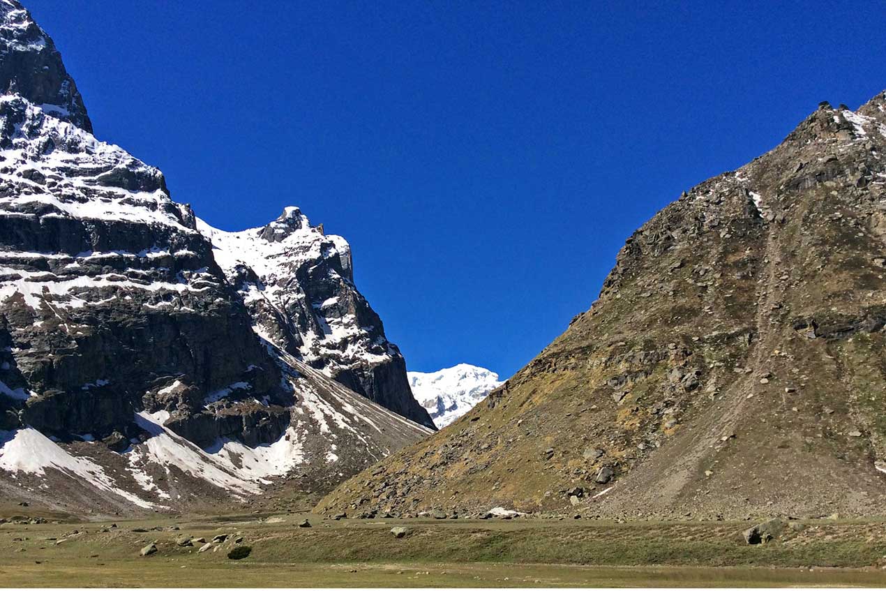
From our gallery
Photos of Pin Parvati trek

Itinerary
Day 1 Reaching Kalgha.
Day 2 From Kalgha to Kheer Ganga.
Day 3 From Kheer Ganga to Thunda Bhuj.
Day 4 From Thunda Bhuj to Thakur Kuan.
Day 5 From Thakur Kuan to Odi Thach.
Day 6 From Odi Thach to Mantalai lake.
Day 7 From Mantalai lake to base camp I (Parvati side)
Day 8 From base camp I to base camp II (Pin side)
Day 9 From base camp II to Tiya.
Day 10 From Tiya to Mud.

Share your feedback
Thank you for sharing your experience! Your feedback is invaluable and inspires fellow travelers to choose responsible tourism when they journey with us.