Our best treks in Ladakh in 2026

What it means to trek in Ladakh
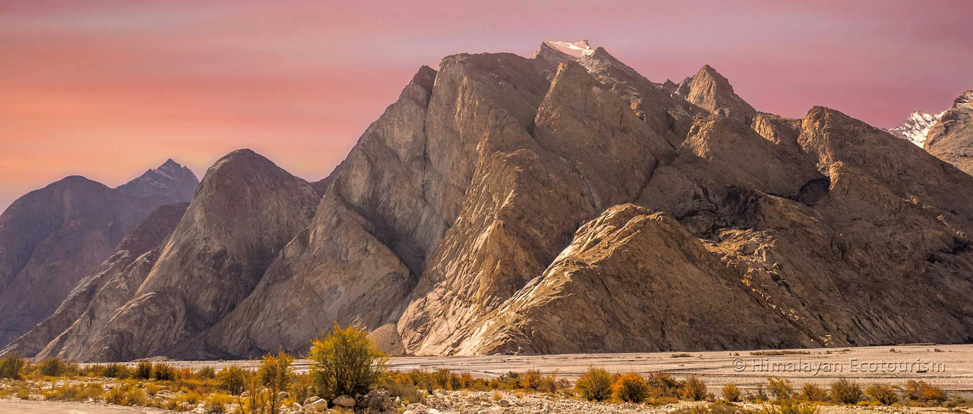
Ladakh is unlike any other trekking destination. As a high-altitude mountainous desert, its landscapes stand in stark contrast to the lush, forested mountain ranges found elsewhere. Here, the mountains are completely barren, revealing their raw geological architecture in a way that few places on Earth can.
In western Ladakh, dramatic rock formations, colorful strata, deep gorges, and towering glaciers tell the story of the incredible collision between the Indian and Asian tectonic plates. The sharp mountain ridges and steep, fossilized seabeds offer a rare glimpse into the geological forces that shaped this relatively young mountain range.
On the eastern side, the landscapes soften into rolling curves, resembling the vast, open plateaus of Tibet. In fact, Ladakh shares the same high-altitude Changthang Plateau as Tibet, with only an international border separating them.
We have expertise in all the following treks.
How to choose the best trek in Ladakh ?
This page gives you detailed information on most of the treks you can do in Ladakh, including their location, duration, and difficulty.
To navigate easily, start with the trekking map below – it gives you an overview of the different trekking regions. Then, follow the links to your chosen region, where treks are sorted by duration.

The Ladakh trekking experience
Beyond its striking landscapes, several factors make trekking in Ladakh a truly unique experience:
High Altitude: Most treks begin above 3,500m, requiring proper acclimatization. The thinner air means that even seasoned trekkers may find their stamina reduced, with altitude gains per hour significantly lower than in lower mountain ranges like the Alps.
Remoteness & Solitude: With a sparse population density, Ladakh offers a rare sense of isolation amid its towering peaks. Many treks require camping in pristine wilderness, as reaching the next village in a single day’s walk is often impossible.
Village Life & Culture: Staying in a Ladakhi homestay is a highlight of many treks. These villages, some perched above 4,000m, are living testaments to centuries of ingenuity – where terraced fields flourish in an otherwise barren land, irrigated by glacial meltwater through ancient irrigation systems.
Spirituality & Sacred Sites: Tibetan Buddhism is deeply woven into daily life in Ladakh. The warmth and kindness of the people reflect this spiritual heritage, which is also visible in the countless monasteries (Gompas), sacred stupas, and mountain passes adorned with fluttering prayer flags spreading messages of peace and compassion.
Map of the best treks in Ladakh

Ladakh – Map of the major treks
On this page, we’ll help you choose the best trek in Ladakh by considering key factors such as location, duration, best time to go and difficulty level. Whether you seek adventure, cultural immersion, or breathtaking solitude, Ladakh’s trails offer an experience like no other.
You can also read this page to get more practical information about trekking in Ladakh : A complete guide for your trek.
To help you find the best trek for you, we have categorized them first by region and then by duration.
Treks in Markha Valley and Hemis National Park
Zingchen (Spituk) to Stok Trek
Duration of the Zingchen (Spituk) to Stok Trek
The Zingchen (Spituk) to Stok Trek can be done in 2 or 3 days, depending on your progress on the first day.
When to go for the Zingchen (Spituk) to Stok Trek
The best time top go to the Zingchen (Spituk) to Stok Trek is from July to October.
What is the difficulty level of the Zingchen (Spituk) to Stok Trek
The Zingchen (Spituk) to Stok Trek is rated “Moderate”, but the day between Rumbak and Stok can be exhausting.
What is the maximum altitude of the Zingchen (Spituk) to Stok Trek
The Zingchen (Spituk) to Stok Trek takes you through the Stok La at 4880m elevation.
A short but beautiful classic trek inside Hemis National Park. While it originally started at Spituk monastery, road access now allows you to begin directly from Zingchen after visiting Spituk. This region is well known for its incredible wildlife – blue sheep, ibex, marmots, and in winter, the elusive Snow Leopard.
Itinerary of the Zingchen (Spituk) to Stok Trek
- Day 1 : Leh (3500 m) to Zingchen (3400 m) via Spituk (3250 m) – Enjoy a scenic drive from Leh, stopping to visit the ancient Spituk monastery with its spiritual atmosphere and dramatic hilltop location. From there, continue by vehicle to the village of Zingchen. Depending on your preference, you can stay in a cozy homestay in Zingchen or walk further (about two hours) to reach the picturesque village of Rumbak nestled higher in the valley.
- Day 2 : Zingchen to Rumbak (3995 m) – If you spent the night in Zingchen, the trail to Rumbak is a pleasant and relaxed hike. The path winds through narrow gorges and dramatic rock formations. This is a good opportunity to experience the tranquility of Ladakhi village life, engage with locals, and enjoy birdwatching along the way.
- Day 3 : Rumbak to Stok (3530 m) – This is the main trekking day. You will ascend to the Stok La pass (4880 m), which offers awe-inspiring views of the surrounding peaks and valleys. The geological formations here are truly unique. After taking in the breathtaking scenery, begin your long but stunning descent into the Stok valley where your trek concludes.

Zingchen (Spituk) to Stok Trek
One of the shortest trek of Ladakh accessible from Leh.
Classic Markha Valley Trek

Classic Markha Valley Trek
The Markha valley has remained one of the favorite treks of Ladakh.
What is the duration of the classic Markha Valley Trek
The duration of the classic Markha Valley Trek is 4 to 5 days. Doing it in 5 days offers you a better acclimatization to the high altitude.
When to go to the classic Markha Valley Trek
The best time to go to the classic Markha Valley Trek is from July to October.
What is the difficulty level of the classic Markha Valley Trek
The classic Markha Valley Trek is rated “Moderate to Challenging”.
What is the maximum altitude of the classic Markha Valley Trek
The classic Markha Valley Trek takes you through the Kongmaru La pass at 5260 m elevation.
This iconic trek is one of the best-known routes in Ladakh, passing through remote villages, high mountain passes, and the beautiful landscapes of Hemis National Park. Due to recent road construction, parts of the trail are now accessible by vehicle – for instance, you can reach Sara by road, which used to be a full day’s walk. While this has made the trek more accessible, the heart of the journey remains untouched, with scenic trails, dramatic gorges, and culturally rich villages along the way.
If you are open to discovering alternatives to this classic route, we also offer several less-frequented trails in the Zanskar and Changthang regions that you can explore on our website.
Spituk to Matho Trek
Duration of the Spituk to Matho Trek
The Spituk to Matho Trek can be done in 4 or 5 days, depending on your progress on the first day or if you want to take a break at Mankarmo campsite.
When to go for the Spituk to Matho Trek
The best time top go to the Spituk to Matho Trek is from July to October.
What is the difficulty level of the Spituk to Matho Trek
The Spituk to Matho Trek is rated “Moderate”, but the day between Rumbak and Stok can be exhausting.
What is the maximum altitude of the Spituk to Matho Trek
The Spituk to Matho Trek takes you through the Stok La at 4880 m elevation and then the Matho La at 4960 m.
This beautiful route is an extension of the Zingchen to Stok trek. If you have a couple of extra days and want to explore deeper into the Hemis National Park, this trek is perfect. From the Mankarmo campsite (4370 m), rather than descending to Stok, you continue towards Matho.
- Additional Days : Climb to the Matho La pass (4960 m), offering one of the best panoramic views of the Stok Kangri range. After the climb, descend to the Gangpoche campsite and enjoy a night under the stars. The following day, make your way to the charming village of Matho. A stay in a local homestay allows for a visit to the unique Matho monastery, known for its annual oracle festival and ancient Buddhist artifacts.

Spituk to Matho Trek
An extended trek into the Hemis National Park.
Skiu, Rumbak, Stok, and Shang Trek

Skiu, Rumbak, Stok, and Shang Trek
From the Markha valley to the core of the Hemis National Park.
What is the duration of the Skiu, Rumbak, Stok, and Shang Trek
The duration of the Skiu, Rumbak, Stok, and Shang Trek is 5 to 6 days.
When to go to the Skiu, Rumbak, Stok, and Shang Trek
The best time to go to the Skiu, Rumbak, Stok, and Shang Trek is from July to October.
What is the difficulty level of the Skiu, Rumbak, Stok, and Shang Trek
The Skiu, Rumbak, Stok, and Shang Trek is rated “Moderate to Challenging”.
What is the maximum altitude of the Skiu, Rumbak, Stok, and Shang Trek
The highest pass met on the Skiu, Rumbak, Stok, and Shang Trek is the Matho La pass at 4960 m elevation.
An extraordinary trek that allows you to traverse Hemis National Park from west to east, starting from the Markha Valley and concluding near Hemis monastery.
This trek passes through remote mountain landscapes, lesser-known valleys, and offers exceptional opportunities to observe wildlife and immerse in raw Himalayan wilderness. You’ll experience traditional villages, high passes, and secluded camping spots that very few trekkers get to enjoy.
Kang Yatse II Trek
Duration of the Kang Yatse II Trek
The Kang Yatse II Trek can be done in 8 days, exclusive of the days spent in Leh before the expedition for acclimatization.
When to go for the Kang Yatse II Trek
The best time top go to the Kang Yatse II Trek is from June to October.
What is the difficulty level of the Kang Yatse II Trek
The Kang Yatse II Trek is rated “Challenging” due the very high altitude and the steep climb to the peak.
What is the maximum altitude of the Kang Yatse II Trek
The Kang Yatse II Trek takes you to the summit II at 6200 m elevation.
Kang Yatse II is a majestic peak in the Markha Valley region of Hemis National Park. It offers a real mountaineering experience without the need for highly technical climbing skills. This trek is ideal for adventurous travelers who want to push their limits at high altitude in a safe and responsible way.
Although the summit is at 6200 m, it is considered non-technical. You will need to use crampons and ropes, and all necessary equipment and guidance will be provided at the base camp, where you’ll also acclimatize. No prior mountaineering experience is required, but good physical fitness and a love for adventure are a must.
This experience replaces the now-closed Stok Kangri trek, which suffered from over-tourism. At Heco, we take great care to ensure that our expeditions are eco-conscious and community-friendly. That’s why we’ve received international recognition for our ethical trekking practices.

Kang Yatse II Trek
A peak expedition that remains a trek without the need of mountaineering skills.
Snow Leopard Trek (Winter Trek)

Snow Leopard Trek in Hemis National Park
The perfect trek for wildlife photographers and for nature lovers !
What is the duration of the Snow Leopard Trek
The duration of the Snow Leopard Trek is 4 to 6 days, but one can decide to extend it for more spotting.
When to go to the Snow Leopard Trek
The best time to go to the Snow Leopard Trek is from January to March.
What is the difficulty level of the Snow Leopard Trek
The Snow Leopard Trek doesn’t pose any challenges except the winter cold conditions of Ladakh.
What is the maximum altitude of the Snow Leopard Trek
The highest elevation met on the Snow Leopard Trek depends on where your spotters will take you to enhance the conditions of observation.
This special winter trek is focused on tracking and spotting the elusive Snow Leopard in its natural habitat within Hemis National Park. There is perhaps no greater thrill than observing this magnificent and endangered predator in the wild. Our treks are led by experienced wildlife trackers who work in close coordination with local communities.
Beyond adventure, this trek is part of our conservation mission. Snow Leopards are often viewed as threats by villagers because they prey on livestock. But through responsible tourism, we help shift the perception – making wildlife a valuable part of the local economy. When communities see real benefits from conservation, they become powerful allies in protecting these species.
Treks on the Changthang Plateau
The Yak Trek : Kargyam to Likchey
Duration of the Yak Trek
Our Yak Trek is done in 5 days, exclusive of the days spent in Leh for acclimatization.
When to go for the Yak Trek
The best time top go to the Yak Trek is from April to September.
What is the difficulty level of the Yak Trek
The Yak Trek is rated “Easy to Moderate”.
What is the maximum altitude of the Yak Trek
The Yak Trek takes you to a max elevation of 4200 m.
If you dream of walking through a living cultural landscape untouched by mass tourism, the Yak Trek offers a rare glimpse into the soul of Ladakh. This gentle, immersive journey takes you across the Kargyam Valley, home to the Changpa nomads, whose lifestyle hasn’t changed for centuries.
You’ll walk side by side with herds of yaks, sheep, and goats, camping in wide valleys that echo with the sounds of the wind and the distant rumble of hooves. At the heart of the experience is not just the scenery – but the human connection. You’ll have the chance to interact with nomadic families, help gather firewood or tend animals, and understand what it means to live in harmony with this fragile ecosystem.
Expect a mix of open pastures, highland wetlands teeming with birdlife, and soft riverbeds crisscrossing the arid plateau. The terrain is not difficult, making it perfect for those seeking an authentic experience rather than an athletic challenge.
Unique highlights :
- Visit working Changpa camps and experience nomadic hospitality.
- Observe yak milking, wool spinning, and the making of traditional butter and cheese.
- Spot wildlife like black-necked cranes, kiangs (wild asses), and foxes in their natural habitat.
- End your journey near Likchey, a remote village framed by ochre hills and poplar groves.

Yak Trek
A unique experience, sharing the life of the Changpa nomads.
Tso Moriri to Kibber Trek (via Parang La)

Tso Moriri to Kibber Trek
A superb trek connecting Ladakh with the region of Spiti.
What is the duration of the Tso Moriri to Kibber Trek
The duration of the Tso Moriri to Kibber Trek is 7 days.
When to go to the Tso Moriri to Kibber Trek
The best time to go to the Tso Moriri to Kibber Trek is from July to October.
What is the difficulty level of the Tso Moriri to Kibber Trek
The Tso Moriri to Kibber Trek is rated as “Moderate to challenging”.
What is the maximum altitude of the Tso Moriri to Kibber Trek
The Tso Moriri to Kibber Trek takes you through the Parang La pass at an elevation of 5590 m.
This iconic trans-Himalayan trail is one of the wildest and most visually dramatic in Ladakh. Starting from the turquoise shores of Tso Moriri, you’ll head southeast into uninhabited valleys, tracing the path once used by ancient traders between Ladakh and Spiti.
The landscape shifts from high-altitude wetlands to sculpted canyons, with towering peaks forming a jagged skyline. The trek builds up to the thrilling Parang La pass (5590m), a crossing that offers 360-degree views of Ladakh and Spiti’s stark beauty. The descent brings you to Kibber, one of the highest villages in the world, nestled in the Spiti Valley.
Why this trek stands out :
- Traverse a truly remote region with no villages or permanent settlements en route.
- Camp under clear, starlit skies with views stretching across the Tibetan Plateau.
- Discover ancient geological formations and fossil beds that tell the story of the Himalayas’ birth.
- Cross the mighty Parang La – a rite of passage for serious trekkers.
Detailed itinerary of the Tso Moriri to Kibber trek
Day 1: Korzok – Kyangdam
- An easy walk along Tso Moriri’s western edge. Birds, grazing livestock, and the mirror-still lake make this a gentle, meditative start.
Day 2 : Kyangdam – Nurboo Sumdo
- Hike through rolling meadows and sandy riverbanks, entering the remote Pare Chu valley.
Day 3: Nurboo Sumdo – Getpa Buzak
- The valley narrows, and the silence deepens. Gradual ascent through isolated terrain.
Day 4: Getpa Buzak – Dutung
- One of the most beautiful sections, with colorful hills and expansive views.
Day 5: Dutung – Parang La Base
- Short day to prepare for the pass. The air is thin, and the excitement builds.
Day 6: Cross Parang La – Camp at Taghlank
- A tough climb rewarded with views across Ladakh and Spiti. The descent is steep but unforgettable.
Day 7: Taghlank – Kibber
- Gentle walk to the finish line. Explore Kibber or transfer to Kaza, the capital of Spiti.
Rumtse to Tso Moriri Trek
Duration of the Rumtse to Tso Moriri Trek
The Rumtse to Tso Moriri Trek is done in 8 days, exclusive of the days spent in Leh for acclimatization.
When to go for the Rumtse to Tso Moriri Trek
The best time to go to the Rumtse to Tso Moriri Trek is from June to October.
What is the difficulty level of the Rumtse to Tso Moriri Trek
The Rumtse to Tso Moriri Trek is rated “Challenging” because of the duration of the trek at above 4500 m elevation.
What is the maximum altitude of the Rumtse to Tso Moriri Trek
The highest pass encountered on the Rumtse to Tso Moriri Trek is the Yalung Nyau La at 5440 m.
This is one of Ladakh’s last great wilderness routes. Starting from Rumtse, just east of Leh, this 8-day trek leads you over seven high-altitude passes, each revealing a new vista—valleys dotted with wildflowers, herds of kiang galloping across the plains, and distant salt lakes glinting in the sun.
What makes this trek extraordinary is the consistency of altitude—you’ll remain above 4000m for nearly the entire journey, immersing yourself in the stark, surreal beauty of the Changthang. Few treks offer such a sustained feeling of remoteness.
Highlights include :
- Crossing passes like Kyamar La (5120m), Mandalchan La (5200m), and Shibuk La (5270m).
- Camping near sacred lakes like Tso Kar, known for its salt crusts and flamingo flocks.
- Spotting wildlife including blue sheep, wolves, and Tibetan snowcock.
- Ending at Korzok on the banks of Tso Moriri, one of Ladakh’s holiest and most beautiful lakes.

Rumtse to Tso Moriri Trek
Seven high-altitude passes, Tso Kar and Tso Moriri, the Changspa nomads on this unique trek.
Markha (or Hemis) to Tso Moriri Trek or to Kharnak

Markha (or Hemis) to Tso Moriri Trek
Start on a classic trekking route, continue on a virtually unknown trail.
What is the duration of the Markha to Tso Moriri Trek
The duration of the Markha to Tso Moriri Trek is 11 days.
When to go to the Markha to Tso Moriri Trek
The best time to go to the Markha to Tso Moriri Trek is from July to October.
What is the difficulty level of the Markha to Tso Moriri Trek
The Markha to Tso Moriri Trek is rated as “Moderate to challenging”.
What is the maximum altitude of the Markha to Tso Moriri Trek
The Markha to Tso Moriri Trek takes you through the Parang La pass at an elevation of 5440 m.
This epic cross-region trek is a journey through Ladakh’s entire ecological spectrum – from the lush, willow-lined riverbeds of the Markha Valley to the haunting openness of the Changthang Plateau. It’s a trail that links not just landscapes, but also histories, communities, and spiritual traditions.
Ideal for seasoned trekkers, the route takes you through remote villages, over four major passes, and into nomadic lands where you’ll likely be the only visitors. If you’re looking for a complete and immersive Himalayan experience – this is it.
Highlights of the Markha to Tso Moriri trek :
- Hike through Hemis National Park, home to snow leopards and golden eagles.
- Cross high passes like Zalung Karpo La (5188m) and Yalung Nyau La (5440m).
- Experience the cultural contrast between settled villagers and nomadic Changpas.
- End at Tso Moriri, surrounded by gigantic mountains and a monastery.
Detailled itinerary of the Markha (or Hemis) to Tso Moriri trek
Day 1: Sara (3530m) to Markha (3800m)
- The trek begins from the village of Sara in the Markha Valley. Follow the scenic valley trail to reach the beautiful village of Markha, surrounded by barley fields and traditional Ladakhi houses.
Day 2: Markha (3800m) to Thachungtse (4260m)
- Trek from Markha to Thachungtse via Hankar village. You’re now in the upper Markha valley with the majestic Kang Yatse massif coming into view — a perfect backdrop for the night’s camp.
Day 3: Thachungtse (4260m) to Yakrupal (4754m)
- The trail leaves the main valley and veers west of Kang Yatse, heading towards the Zalung Karpo La pass. Camp at Yakrupal, a peaceful spot near the river, surrounded by high-altitude wilderness.
Day 4: Yakrupal (4754m) to Tantse (4135m)
- Cross the spectacular Zalung Karpo La pass at 5188m. The views are unforgettable, with numerous 6000m+ peaks around. The descent is steep and requires caution — follow your guide’s instructions. Continue descending to reach Tantse, a serene spot at the confluence of rivers with shady trees.
Day 5: Tantse (4135m) to Dat (4330m)
- Follow the Chang Chu river upstream to reach Khurna Dat, a small nomadic village known for its traditional stone houses and yak/pashmina goat enclosures. A unique cultural experience.
Day 6: Dat (4330m) to Lungmo Che (4650m)
- Ascend gradually toward Yar La pass (4950m), a jeepable mountain pass. Cross the pass and camp at Lungmo Che, a picturesque alpine meadow below the pass.
Day 7: Lungmo Che to Yagang / Transfer to Pongunagu
- A short hike leads to Yagang where you may encounter Changpa nomads. From here, we can arrange a transfer across the Manali–Leh highway to reach Pongunagu near the Tso Kar lake.
Day 8: Pongunagu to Nuruchan (Camping)
- Begin the second part of the journey following the classic route from Tso Kar to Tso Moriri. Today’s trek takes you from Pongunagu to the peaceful campsite at Nuruchan.
Day 9: Nuruchan to Rajung Karu
- Enjoy a more relaxed day as you gradually gain altitude and trek to Rajung Karu, surrounded by sweeping valleys and grazing herds.
Day 10: Rajung Karu to Gyamar via Kyamayuri La (5420m) and Kartse La (5390m)
- This is a challenging but rewarding day. Cross two high passes as you navigate through the Korzok range, with the magnificent Mentok I and II peaks in sight. Camp at Gyamar.
Day 11: Gyamar to Karzok via Yalung Nyau La (5440m)
- Your final day takes you over the Yalung Nyau La, the highest pass of the trek. From the top, enjoy an epic descent to Karzok, the picturesque village on the shores of Tso Moriri lake — a perfect end to this high-altitude adventure.
Treks Treks Towards the Nubra Valley
Phyang to Hunder Dok Trek – Nubra Valley
Duration of the Phyang to Hunder Dok Trek
The Phyang to Hunder Dok Trek (Nubra valley) is done in 5 days.
When to go for the Rumtse to the Phyang to Hunder Dok Trek
The best time to go to the Phyang to Hunder Dok Trek (Nubra valley) is from July to October.
What is the difficulty level of the Rumtse to the Phyang to Hunder Dok Trek
The Phyang to Hunder Dok Trek (Nubra valley) is rated “Moderate” with a passage on an easy glacier.
What is the maximum altitude of the Rumtse to the Phyang to Hunder Dok Trek
The highest pass encountered on the Phyang to Hunder Dok Trek (Nubra valley) is the Lasermo La at 5450 m.
This lesser-known trek is an excellent option for those who enjoy full camping treks and crossing high passes. Starting near Leh, it takes you through stunning high-altitude landscapes and gives you the chance to hike on a glacier at the top of the pass.
The real bonus? You’ll reach the enchanting Nubra valley on foot, bypassing the typical drive over Khardung La. The destination, with its wide valleys and dramatic contrasts, is the perfect reward after the journey.

Nubra Valley trek from Phyang
At the Lasermo La, the trek requires to walk on a glacier at 5450 m.
Saboo to Digar Trek – Nubra Valley

Saboo to Digar Trek – Nubra Valley
Another way to reach the Nubra valley using your two legs only !
What is the duration of the Markha to Tso Moriri Trek
The duration of the Saboo to Digar Trek in Nubra is 3 to 4 days.
When to go to the Markha to Tso Moriri Trek
The best time to go to the Saboo to Digar Trek in Nubra is from June to October.
What is the difficulty level of the Markha to Tso Moriri Trek
The Saboo to Digar Trek in Nubra is rated as “Moderate”.
What is the maximum altitude of the Markha to Tso Moriri Trek
The Saboo to Digar Trek in Nubra takes you through the Digar La pass at an elevation of 5430 m.
This trek is a great alternative to the Phyang–Hunder route, offering another scenic way to reach the Nubra valley on foot. It starts from the village of Saboo, just outside Leh, making it very accessible.
Itinerary of the Saboo to Digar trek in Nubra
- Day 1: From Leh, drive to the upper part of Saboo, called Saboo Phu. From there, a 6 km hike brings you to the base camp of Digar La at 4,600 m.
- Day 2: Cross Digar La (5,430 m). The final ascent is steep but well-marked. Descend to the campsite at Chumik Yongma (4,620 m).
- Day 3: Enjoy a gradual descent to Digar village (3,980 m), where the trail ends. The village is connected by road, making your return easy.
A short but rewarding trek, ideal if you want to experience Ladakh’s remote beauty and reach Nubra valley without the road journey.
Treks in the Sham Valley
The Baby Trek of Ladakh : Likir to Tingmosgam and Skindiyang
Duration of the Baby Trek
The Likir to Tingmosgam and Skindiyang trek is done in 3 to 4 days, or even less if you want to skip some parts of it. For instance you could start from Yangthang and end the trek at Tingmosgam in 2 days.
When to go for the Rumtse to the Baby Trek of Ladakh
The best time to go to the Likir to Tingmosgam and Skindiyang trek is April to October, but you can actually do it throughout the year, especially in winter if your purpose is to spot the Snow Leopard.
What is the difficulty level of the Rumtse to the Baby Trek of Ladakh
The Likir to Tingmosgam and Skindiyang trek is rated “Easy” with no difficult stretches at all.
What is the maximum altitude of the Baby Trek of Ladakh
The highest altitude of the Likir to Tingmosgam and Skindiyang trek is 4075 m. But the other passes like the Mebtak La and Chagatse La remain below 4000 m.
Once the most popular beginner-friendly trek in Ladakh, this route winds through charming villages, apricot orchards, and ancient monasteries.
Though a small road now connects the villages, it’s still possible to enjoy the trail by carefully following paths that avoid the road.
You can also tailor the trek by starting or ending it at different points along the way, depending on your time and interest.

The Baby trek of Ladakh
Probably the easiest trek of Ladakh with small valleys, lower passes and charming villages.
Snow Leopard Trek near Uley

Snow Leopard Trek near Uley
Uley in the Sham valley is one of the best place of the Sham valley to spot the Snow Leopard.
What is the duration of the Snow Leopard Trek near Uley
The duration of the Snow Leopard Trek near Uley is depending on your availability and your luck ! We recommend you to plan at least 4 days to get the chance to spot it.
When to go to the Snow Leopard Trek near Uley
The best time to go to the Snow Leopard Trek near Uley is from January to March.
What is the difficulty level of the Snow Leopard Trek near Uley
The Snow Leopard Trek near Uley is rated as “Easy”, as it doesn’t involve long days of trek, but rather follow your tracker who knows where the Leopards are from their early morning observations.
What is the maximum altitude of the Snow Leopard Trek near Uley
The Snow Leopard Trek near Uley takes you through mild elevations of about 4200 m.
Is this truly a trek? That depends on the elusive cat.
In winter, you’ll stay in a homestay in Uley village, waiting with your guide and spotter for any sign of the Snow Leopard. Sometimes, you might be lucky and spot it right near the village. Other times, the search takes you into higher terrain for short hikes or longer climbs through snowy landscapes.
This is a unique and immersive experience that combines wildlife tracking, village life, and winter trekking.
Contact us to organize your Snow Leopard expedition in the Sham Valley.
Treks in the Zanskar Range
Tso Marpo Trek
Duration of the Tso Marpo Trek (Red Lake)
The Tso Marpo Trek (Red Lake) is done in 3 to 4 days, although you can just go enjoy our nomadic camp in 2 days.
When to go to the Tso Marpo Trek (Red Lake)
The best time to go to the Tso Marpo Trek (Red Lake) is from end of July to October.
What is the difficulty level of the Tso Marpo Trek (Red Lake)
The Tso Marpo Trek (Red Lake) is rated “Moderate” till the Red lake to Challenging if you go till the Blue lake.
What is the maximum altitude of the Tso Marpo Trek (Red Lake)
The highest altitude of the Tso Marpo Trek (Red Lake) is 5070 m at the Red lake and 5570 m at the Mangthang La.
Opened in 2023 by Himalayan Ecotourism under our “Reinventing Tourism in Ladakh” initiative, the Tso Marpo trek is a unique route starting from Photoksar.
After the first day of trekking, you reach our high-altitude nomadic camp at 4,700 m, where you’ll stay in yak wool tents equipped with proper bedding, solar lights, and traditional décor for comfort in the wild.
Tso Marpo means “Red Lake” in Ladakhi, named after the iron-rich minerals that give the lake its vibrant hue. Surrounded by glaciers, this otherworldly lake lies near the Mathang La pass. If you’re up for more adventure, you can trek across a glacier to a second lake – this time blue in color – just below the pass.
On the third day, either return to Photoksar or go for a day hike to the Kangri Mermer glacier.

Tso Marpo Trek (Red Lake)
This trek is organized by Heco in the context of our “Reimagining tourism in Ladakh” initiative.
Stongdey to Phuktal Trek

Stongdey to Phuktal Trek
A lesser known but wonderful trek in the Eastern part of the Zanskar range.
What is the duration of the Stongdey to Phuktal Trek
The duration of the Stongdey to Phuktal Trek is 4 days.
When to go to the Stongdey to Phuktal Trek
The best time to go to the Stongdey to Phuktal Trek is from June to October.
What is the difficulty level of the Stongdey to Phuktal Trek
The Stongdey to Phuktal Trek is rated as “Moderate”.
What is the maximum altitude of the Stongdey to Phuktal Trek
The Stongdey to Phuktal Trek takes you through the Stongdey La pass at 5162 m.
A scenic and remote trail connecting two of Zanskar’s most beautiful monasteries: Stongdey and Phuktal.
Itinerary of the Stongdey to Phuktal trek
- Day 1: From Padum, drive to Stongdey or stay overnight in the village. Begin the trek by climbing the Stongdey La (5,162 m). After the pass, descend to the picturesque campsite known as “the Junction” (4,250 m).
- Day 2: A pleasant descent through a narrowing valley and into a steep gorge until reaching the remote village of Shade. Overnight in a homestay or tent.
- Day 3: Continue descending toward the Tsarap River. The vibrant blue river contrasts beautifully with the surrounding orange-brown mountains. Trek alongside the river to reach the Phuktal Monastery. Stay in a nearby homestay.
- Day 4: A short descent leads to the village of Purne, where a vehicle can pick you up for onward travel.
Lamayuru to Chilling Trek
Duration of the Lamayuru to Chilling Trek
The Lamayuru to Chilling Trek is done in 4 to 5 days.
When to go to the Lamayuru to Chilling Trek
The best time to go to the Lamayuru to Chilling Trek is from July to October.
What is the difficulty level of the Lamayuru to Chilling Trek
The Lamayuru to Chilling Trek is rated “Moderate to Challenging”.
What is the maximum altitude of the Lamayuru to Chilling Trek
The highest altitude of the Lamayuru to Chilling Trek is 4907 m.
This five-day route offers a condensed version of the first stretch of the classic Zanskar crossing. It’s perfect if you’re short on time but still want a taste of Ladakh’s high-altitude trekking.
You can also extend the trek by continuing into the Markha Valley or toward Rumbak and Stok via the Ganda La (4,968 m).

Lamayuru to Chilling Trek
A wonderful alternative to the former classic Crossing of the Zanskar trek.
Lamayuru to Alchi Trek via Tar La

Lamayuru to Alchi Trek via Tar La
A trek that takes you to some of the most magical villages of Ladakh connected by high passes.
Duration of the Lamayuru to Alchi Trek via Tar La
The duration of the Lamayuru to Alchi Trek via Tar La is 4 to 5 days.
When to go to the Lamayuru to Alchi Trek via Tar La
The best time to go to the Lamayuru to Alchi Trek via Tar La is from June to October.
What is the difficulty level of the Lamayuru to Alchi Trek via Tar La
The Lamayuru to Alchi Trek via Tar La is rated as “Moderate”.
What is the maximum altitude of the Lamayuru to Alchi Trek via Tar La
The Lamayuru to Alchi Trek via Tar La takes you through the Tar La pass at 4915 m.
An alternative to the Lamayuru–Chilling trek, this route passes through the traditional village of Tar, known for its warm homestays and opportunities to engage with village life, especially during harvest season.
Suggested Itinerary of the Lamayuru to Alchi trek via Tar La
- Start by trekking from Lamayuru to Wanla via the Prinkiti La.
- From Phongila, head toward the Tar La, camping at its base.
- Ascend the Tar La and descend into Tar village (3 days total so far).
- Spend two nights in Tar to enjoy the village.
- Continue to Mangyu via the Hibti La and Mangyu La (both around 4,145 m).
- Overnight at Mangyu and end your trek by walking or driving to Alchi.
Kanji to Lingshed Trek
Duration of the Kanji to Lingshed Trek
The Kanji to Lingshed Trek is done in 7 days.
When to go to the Kanji to Lingshed Trek
The best time to go to the Kanji to Lingshed Trek is from July to October.
What is the difficulty level of the Kanji to Lingshed Trek
The Kanji to Lingshed Trek is rated “Moderate to Challenging”.
What is the maximum altitude of the Kanji to Lingshed Trek
The highest altitude of the Kanji to Lingshed Trek is 5272 m.
This off-the-grid adventure is perfect for trekkers seeking solitude in the wilds of Zanskar. The route crosses three high passes, starting with Kanji La (5272 m), and leads through the pristine village of Dibling before arriving in Lingshed.
The village of Lingshed, with its dramatic monastery perched on a hill, is a rewarding end to this stunning journey.

Kanji to Lingshed Trek
Looking for an unforgetable adventure in the heart of Zanskar far off the beaten track ?
Chadar Trek (Winter Trek)

Chadar Trek (Winter Trek)
A worldwild known trek on the frozen riven of Zanskar.
Duration of the Chadar Trek
The duration of the Chadar Trek is 8 days.
When to go to the Chadar Trek
The best time to go to the Chadar Trek is from January to March.
What is the difficulty level of the Chadar Trek
The Chadar Trek is rated as “Challenging”, mostly because of the winter cold conditions you need to endure during 8 consecutive days.
What is the maximum altitude of the Chadar Trek
The Chadar Trek’s highest altitude is 3570 m.
One of Ladakh’s most iconic treks, the Chadar takes you across the frozen Zanskar River in extreme winter conditions. With temperatures ranging from -20°C to -30°C, this is a true expedition.
Due to climate change, the trek often starts later in January, as it did in 2025. While the trekking portion is five days, be sure to plan extra days for travel and acclimatization.